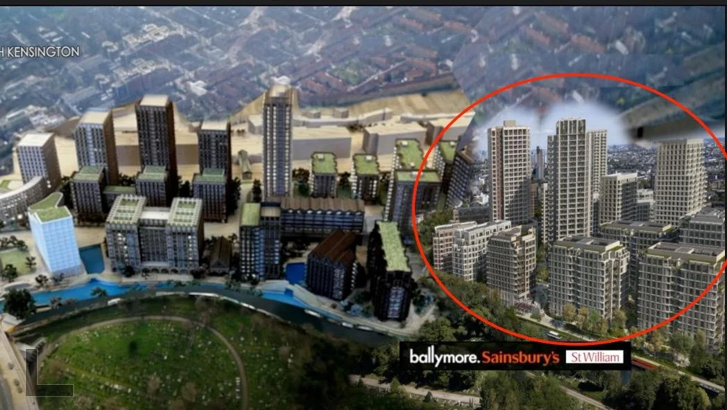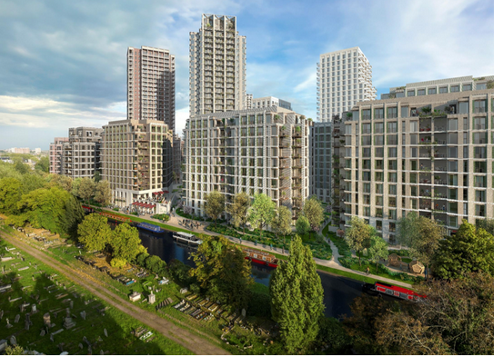
On this page you’ll find a summary of St William’s REVISED plans for the Kensal Gasworks site and a simple guide on “how to object”.
DEADLINE TO OBJECT IS SEPTEMBER 11TH 2026
Deadline to Object is Sept. 11th 2026
St. William Revised Plan
St William Case Ref: PP/25/03535
Over the next few weeks we will continue to update this page with additional information about St William’’s revised application
You can now access summary reports on key issues such as Housing, Transport, Heritage, Environment, Bomb threat (UXO’s) and Contamination.
If you would like to object or comment on St William’s plans click on the link below and go to the Comments Section of the RBKC Planning Portal.
Select OBJECT from the drop-down menu and post your comment
Click here for: RBKC Planning Portal
Scroll down to view some Example Objections
Example Objections
Here are some ‘example’ objections on specific issues to help you get started.
You can find more information about these issues in the section above called Summary Reports
Click on the buttons below to view example objections:
Summary Reports
We have prepared summaries of St William’s planning application documents. You can find the original documents on the RBKC planning portal
Environmental Report
Contamination Report
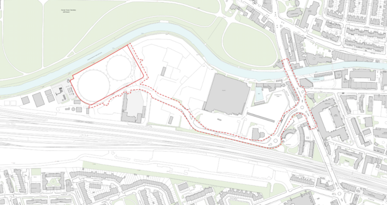
Canal Way is a summary of St William’s alternative “Standalone” plan if Ballymore’s plan is rejected by the Mayor of London.
Traffic Report
Cemetery_Environmental Impact

Housing Report *affordable Housing now reduced to 16%

Download St William Submission Docs for a “deeper dive”
When they start work on the site, how noisy will it be? Will my bedroom shake?
** St William 1st submission June 2025**
St William have submitted TWO ‘Hybrid’ planning applications:
St William Application No.1 - THE MASTERPLAN
This application assumes Project Flourish will be approved by RBKC.
Effectively, this means St William and Ballymore will be remediating, excavating, transporting toxic waste (70 lorries a day) and building on-site at the same time for the next 10-15 years.
St William Application No.2 - STANDALONE
If Project Flourish Is NOT approved, St William contend that their development is viable as a “standalone”.
This second application is for “improvement works” to Ladbroke Grove junction and Canal Way to facilitate alternative access to the site.
The “Hybrid” application
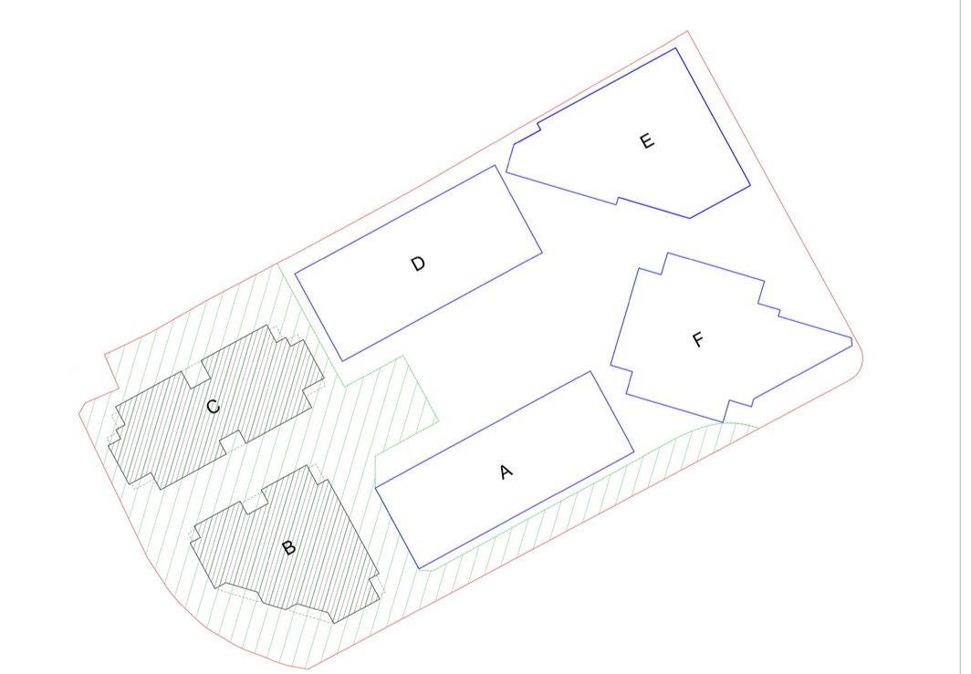
St William is only required to supply detailed information about part of the site (Plots B and C) and an overview of the rest of the development
Ground Plan showing Tower Blocks A - F
St William “Standalone” plan showing Canal Way Traffic Route
St William plan: Key Issues
Contamination - health impacts

10 years construction - noise and vibration

Traffic chaos
Scroll down to OBJECT section below for example Objection emails and Summary Reports of Key Issues

UXO’s Unexploded WW11 Bombs

Environmental damage: Kensal Green Cemetery and wildlife
Housing - 31 Storey/sunlight and shading /infrastructure